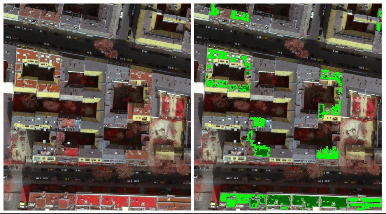
Results of the automated preprocessing (dark green: intensive green roof, light green: extensive green roof, background: infrared aerial image 2016)
On behalf of the Senate Department for Urban Development and Housing, a remote sensing based mapping and inventory of all urban green roofs in Berlin was carried out in cooperation with Digitale Dienste Berlin.
The analysis concept is based on the combined evaluation of current digital aerial photographs (orthophotos) of 2016 as well as planning data and geodata. The aim of the green roof mapping was the city-wide coverage of all vegetated roof areas (spontaneous and planned vegetation developments).
A linking and analysis with other geodata, e.g. Buildings or land use, was derived. The results of the green roof mapping are presented in the Environmental Atlas of Berlin.
The method allows a homogeneously, accurate and cost-effective detection of green roofs. Furthermore repeatability, improvements of the approach and its transferability to other cities are possible.

