Publikationen – Fachzeitschriften
Lehmler, S., Förster, M. & Frick, A. Modelling Green Volume Using Sentinel-1, -2, PALSAR-2 Satellite Data and Machine Learning for Urban and Semi-Urban Areas in Germany. Environmental Management (2023). https://doi.org/10.1007/s00267-023-01826-9
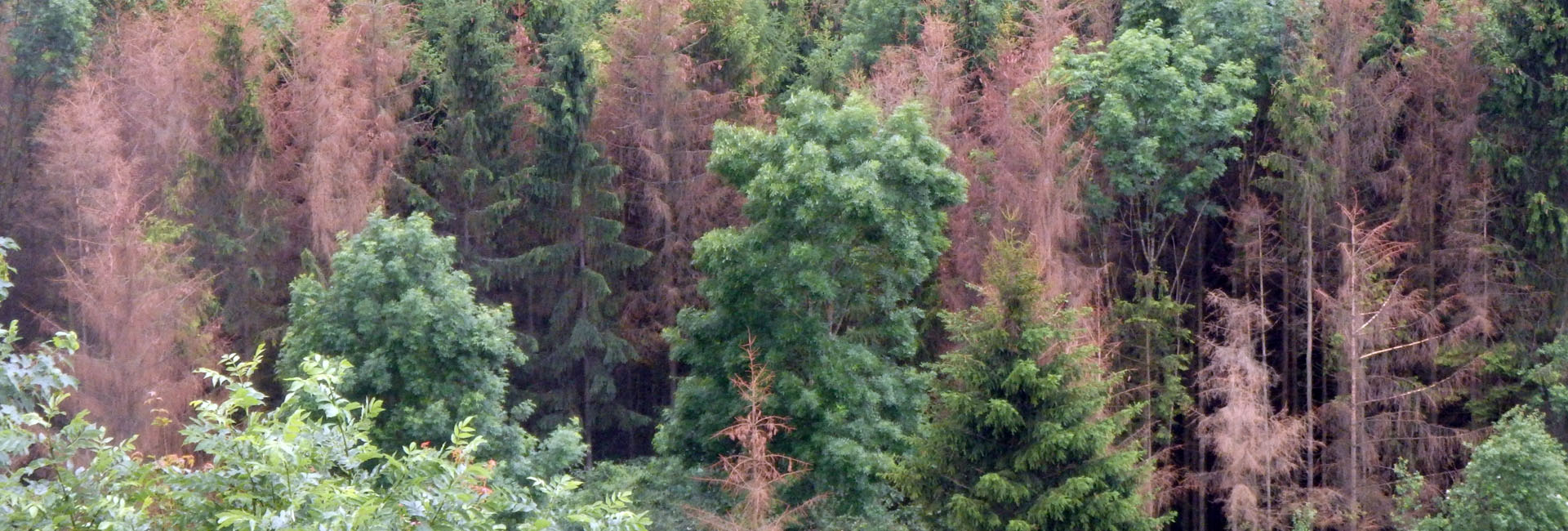
Schiefer, F., Schmidtlein, S., Frick, A., Frey, J., Klinke, R., Zielewska-Büttner, K., Junttila, S., Uhl, A., Kattenborn, T. (2023): UAV-based reference data for the prediction of fractional cover of standing deadwood from Sentinel time series ISPRS Open Journal of Photogrammetry and Remote Sensing, Volume 8, 2023, 100034, ISSN 2667-3932. https://doi.org/10.1016/j.ophoto.2023.100034
Meinel, G., Krüger, T., Eichler, L., Wurm, M., Tenikl, J., Frick, A., … Fina, S. (2022): Wie grün sind deutsche Städte? (BBSR-Online-Publikation, 03/2022). Bonn: Bundesinstitut für Bau-, Stadt- und Raumforschung (BBSR) im Bundesamt für Bauwesen und Raumordnung (BBR). https://doi.org/10.26084/ioer-2022urbgrn
Frick, A., Stöckigt, B. & K. Wagner: Ableitung des Baumbestandes entlang des deutschen Schienennetzes. In: Deutsches Zentrum für Schienenverkehrsforschung beim Eisenbahn-Bundesamt (Eds.): Forschungsbericht 10 (2021), ISSN 2629-7973, doi: 10.48755/dzsf.210007.01
Szymczak, S., Bott, F., Babeck, P., Frick, A., Stöckigt, B. & Wagner, K. (2022): Estimating the hazard of tree fall along railway lines: a new GIS tool. Nat Hazards (2022). https://doi.org/10.1007/s11069-022-05263-5
Frick, A., Wagner, K., Kiefer, T. & S. Tervooren (2020): Wo fehlt Grün? -Defizitanalyse von Grünvolumen in Städten. In Meinel, G., Schumacher, U., Behnisch, M. & T. Krüger (Hrsg.): Flächennutzungsmonitoring XII. IÖR Schriften. Band 78. Rhombos Verlag. Berlin. ISBN: 978-3-944101-78-1
Schiefer, F., Kattenborn, T., Frick, A., Frey, J., Schall, P., Koch, B., Schmidtlein, S.: (2020): Mapping forest tree species in high resolution UAV-based RGB-imagery by means of convolutional neural networks. ISPRS Journal of Photogrammetry and Remote Sensing 170 (2020) 205-215. DOI: 10.1016/j.isprsjprs.2020.10.015
Frick, A. & S. Tervooren (2019): A framework for the long-term monitoring of urban green volume based on multi-temporal and multi-sensoral remote sensing data. Journal of Geovisualization and Spatial Analysis (2019) 3: 6. https://doi.org/10.1007/s41651-019-0030-5
Klinke, R.; Kuechly, H.; Frick, A.; Förster, M.; Schmidt, T.; Holtgrave, A.-K.; Kleinschmit, B.; Spengler, D.; Neumann, C. (2018): Indicator-Based Soil Moisture Monitoring of Wetlands by Utilizing Sentinel and Landsat Remote Sensing Data. PFG – Journal of Photogrammetry, Remote Sensing and Geoinformation Science. https://doi.org/10.1007/s41064-018-0044-5
Förster, M. and Frick, A. (2014): Multitemporale und hyperspektrale Fernerkundung für das Biodiversitätsmonitoring – Aktuelle Forschungsergebnisse und deren Bedeutung für die künftige Nutzung der Sentinel-2-Sensordaten. In: Buck, O. and Hinterlang, D. and Müterthies, A. and Rühl, J. (Eds.): Einsatz von Fernerkundungs-Daten im Rahmen von FFH-Monitoring-Diensten in Deutschland: get ready for SENTINEL @ All, Bonn, pp. 28-35. ISBN: 978-3-89624-123-8
Tegetmeyer, C., Frick, A. & N. Seifert (2014): Modelling habitat suitability in the Aquatic Warbler wintering ground Djoudj National Park in Senegal. OSTRICH (submitted)
Frick, A, Tanneberger, F. & Bellebaum, J. (2014): Model based selection of areas for the restoration of Acrocephalus paludicola habitats in NE Germany, Environmental Management. 01/2014; DOI:10.1007/s00267-014-0234-x
Zerbe, S., Steffenhagen, P., Parakenings, K., Timmermann, T., Frick, A., Gelbrecht, J. & D. Zak (2013): Restoration of ecosystem services after 10 years of rewetting peatlands in NE Germany. Environmental Management. June 2013, Volume 51, Issue 6, pp 1194-1209. doi: 10.1007/s00267-013-0048-2
Schuster, C., Ali, I., Lohmann, P., Frick, A., Förster, M., Kleinschmit, B. (2011): Towards Detecting Swath Events in TerraSAR-X Time Series to Establish NATURA 2000 Grassland Habitat Swath Management as Monitoring Parameter. Remote Sens. 3, no. 7: 1308-1322.
Frick, A., Steffenhagen, P., Zerbe, S., Timmermann, T., Schulz, K. (2011): Monitoring of the vegetation composition in rewetted peatland with iterative decision tree classification of satellite imagery. Photogrammetrie Fernerkundung Geoinformation. Heft 3/2011. doi: 10.1127/1432-8364/2011/0076
Timmermann, T., Steffenhagen, P., Schulz, K., Zerbe, S. & Frick, A. (2011): Vegetationsentwicklung von wiedervernässten Flusstalmooren Mecklenburg-Vorpommerns. Telma. Beiheft 4: 159-182.
Steffenhagen, P., S. Zerbe, A. Frick, K. Schulz, T. Timmermann (2010): Ökosystemleistungen wiedervernässter Niedermoore in Nordostdeutschland – ein Erfolg aktiven Moorschutzes. Naturschutz und Landschaftsplanung. 42 (10). Pp 304-311
Förster, M., Frick, A., H. Walentowski & B. Kleinschmit (2008): Approaches to utilising QuickBird Data for the Monitoring of NATURA 2000 habitats. Community Ecology, Volume 9 (2). pp 155-168.
Haag, L.; B. Coenradie; B. Kleinschmit; A. Damm; P. Hostert; M. Goedecke; TH. Schneider (2008): Hybrides Kartierungsverfahren der Bodenversiegelung im urbanen Raum – das Ergebnis für Berlin. Bodenschutz. Ausgabe 3/2008. S. 82-87.
Kleinschmit, B., Förster, M., Frick, A. & K. Oehmichen (2007): QuickBird Data – experiences with ordering, quality and pan sharpening. In: Photogrammetrie Fernerkundung Geoinformation. Heft 2.
Düvel, M., Frick, A. (2005): Brandenburg, Ersterfassung der Lebensraumtypen nach Anhang I der FFH-RL. Anwendung von höchstauflösenden Satellitendaten bei der Kartierung und Bewertung. In: Natur & Landschaft, Heft 05/2005.
Rath, S., von Liebermann, N., Frick, A. (2006): Fernerkundung im Wasserbau und Küsteningenieurwesen: Eine Standortbestimmung. In: HANSA Journal, Jg. 143, H. 4, S. 78-83.
Frick, A., S. Tervooren (2003): Erholungswert bewahren. Potsdams internetkompatibles Umweltinformationssystem. In: GeoBit/GIS, Nr. 7/2003.
Publikationen – Konferenzbeiträge
Wagner, K., Oswald, S. & A. Frick (2018): Multitemporal soil moisture monitoring by use of optical remote sensing data in a dike relocation area, Proc. SPIE 10783, Remote Sensing for Agriculture, Ecosystems, and Hydrology XX, 107831V (10 October 2018); https://doi.org/10.1117/12.2325319
Frick, A. & S. Tervooren (2018): Anwendung von SENTINEL-2- und Stereo-WorldView-3-Daten für die Fortführung des Umweltmonitorings der Landeshauptstadt Potsdam. In Meinel, G., Schumacher, U., Behnisch, M. & T. Krüger (Hrsg.): Flächennutzungsmonitoring X. IÖR Schriften. Band 76. Rhombos Verlag. Berlin
Förster, M. and Frick, A. (2015): Fernerkundung als Hilfe im Naturschutz – Aktuelle Sensoren und Methoden angewandt auf Großschutzgebiete in Brandenburg. Forum der Geoökologie, 26(1), pp. 22-25.
Gärtner, P., Frick, A., Bahls, A., Kleinschmit, B. (2012): Monitoring von Biotopen an Bundeswasserstraßen mit RapidEye Daten. In: Borg, E., Daedelow, H., Johnson, R. (Eds.): RapidEye Science Archive (RESA) – Vom Algorithmus zum Produkt. Gito, Berlin, pp. 93-109, ISBN: 978-3-942183-61-1.
Lang, S., L. Pernkopf, J. Vanden Borre, M. Förster, B. Haest, O. Buck & A. Frick (2011): Fostering sustainability in European nature conservation – NATURA 2000 habitat monitoring based on Earth observation services. In Proceedings of the 1st World Sustain. Forum, 1-30 November 2011; Sciforum Electronic Conferences Series, 2011
Förster, M., Frick, A., & B. Kleinschmit (2011): Utilization of spectral measurements and phenological observations to detect grassland-habitats with a RapidEye intra-annual time-series. In: 6th International Workshop on the Analysis of Multi-temporal Remote Sensing Images (Multi-Temp), pp. 265-267, Trento, Italy, doi: 10.1109/Multi-Temp.2011.6005099.
L. Haag, A. Frick, G. Weyer & H. Kenneweg (2011): Contributions of Satellite Remote Sensing to Specify Changes of the Ecological Situation: Monitoring of Urban Indices. Conference Proceedings. From Space to Earth. Venice, Italy 21-23. March 2011.
Spengler, D.; Frick, A.; Davey, C.; Peisker, T.; Kaufmann, H. (2011): Estimation of surface soil moisture content using imaging spectroscopy – a simulation. 7th EARSeL SIG IS workshop ‚IMAGING SPECTROSCOPY. Edinburgh, Great Britain. (submitted)
Förster, M. Frick, A. Schuster, C. & Kleinschmit, B. (2010): Object-based Change Detection Analysis for the Monitoring of Habitats in the Framework of the NATURA 2000 Directive with Mulit-temporal Satellite Data. In: Addink, E.A. and F.M.B. Van Coillie (Eds). GEOBIA 2010-Geographic Object-Based Image Analysis. Ghent University, Ghent, Belgium, 29 June – 2 July. ISPRS Vol.No. XXXVIII-4/C7. ISSN: 1682-1777.
Förster, M., Frick, A., Schuster, C., Körth, K., Itzerott, S., Neumann, C., Förster, S. & Kleinschmit, B. (2009): Multi-sensor Approaches for Detecting Protected Plant Communities in a Nature Conservation Heathland Area in Germany. 3rd. Workshop of EARSeL SIG on Remote Sensing of Land Use & Land Cover. Bonn. 125-126.
Haag, L.; A. Frick; K. Pochte & H. Kenneweg (2009): Applied Remote Sensing in the Urban Area of Potsdam/Germany. Proceedings of the III. International Congress on Environmental Planning and Management. 26. – 30. Juli 2009. Seoul.
Notarnicola, C., Frick, A., Kass, S., Rastner, P., Pulighe, G., Zebisch, M. (2009): Semi-automatic classification procedure for updating landuse maps with high resolution optical images. IGARSS’09.
Coenradie, B; L. Haag; A. Damm; P. Hostert; B. Kleinschmit (2007): Hybrid Approach for the Mapping of Sealing with High-Resolution Satellite Data in an Urban Environment. In: KENNEWEG, H. & TRÖGER, U. (eds.) (2007): 2nd International Congress on Environmental Planning and Management – Visions, Implementations, Results. Landschaftsentwicklung und Umweltforschung, Band S20, 145-148.
Frick, A., Coenradie, B., & H. Kenneweg (2007): Environmental monitoring and urban development: application of modern remote sensing methods. Proceedings of the II. International Congress on Environmental Planning and Managment, Berlin.
Clasen, A., Frick, A. & B. Kleinschmit (2006): Knowledge based methods for the classification of forest parameters with QuickBird data. Proceedings of the 2nd Workshop of the EARSeL SIG on Land Use & Land Cover, ISBN-10 3-00-020518-7. Bonn.
Rath, S., Gunawan, B., Pasche, E., Frick, A. & U. Teschke (2006): Roughness parameterization for 2D hydrodynamic models from QuickBird spaceborne imagery. Proceedings River Flow 2006, Lisbon, 6-8 Sept., 2006, R.M.L. Ferreira, E.C.T.L. Alves, J.G.A.B. Leal & A.H. Cardoso (Eds.), Publ. Taylor & Francis, London.
Frick, A. (2006): Urban Monitoring with QUICKBIRD Imagery through a knowledge-based extraction of indices. ISPRS Workshop – Fifth International Symposium, Turkish German Joint Geodetic days, March 29 – 31, 2006, Berlin.
Frick, A., Weyer, G., Kenneweg, H. & Kleinschmit, B. (2005): A Knowledge-based approach to vegetation Monitoring with Quickbird imagery. ISPRS Workshop 2005 – High- Resolution Earth Imaging for Geospatial Information, May 17-20, 2005 , Hannover.
Frick, A. (2005): Evaluation of Natura 2000 habitat types through very high resolution satellite imagery. In: Göttinger Geographische Abhandlungen, Heft 113, GGRS 2004, 1st Göttingen GIS & Remote Sensing Days.
Frick, A. (2004): Unterstützung von Monitoringaufgaben mit OpenSource-Weblösungen – Beispiele für eine interaktive FFH-Gebietsbetreuung in Brandenburg. In: Strobl, Blaschke, Griesebner (Hrsg.): Angewandte Geoinformatik 2004, Beiträge zum 16. AGIT – Symposium Salzburg.
weitere Publikationen
Frick, A. (2011): Vegetationsmonitoring in der Döberitzer Heide auf Basis von Fernerkundungsdaten. In: LUGV (Hrsg.): Bericht zum Workshop „Monitoring in der Döberitzer Heide“. Fachbeiträge des LUGV, Heft Nr. 123. 14-19.
Tanneberger, F., Frick, A. & Bellebaum, J.: The Brandenburg Aquatic Warbler NATURA2000 Species Management Plan and results of a remote sensing analysis of potential habitats. AW Conservation Handbook (submitted)
Tervooren, S. & A. Frick (2010): Bodenversiegelung, Grünvolumen, Biotopwertigkeit – Praktische Erfahrungen des Umweltmonitorings in Potsdam. In Meinel, G. & U. Schumacher (Hrsg.): Flächennutzungsmonitoring II. Konzepte-Indikatoren-Statistik. IÖR Schriften. Band 52. Rhombos Verlag. Berlin
Förster, M. & A. Frick (2010): Einsatzmöglichkeiten von geometrisch, spektral und zeitlich sehr hoch aufgelösten Fernerkundungsdaten für das Biodiversitätsmonitoring. In: Doerpinghaus, A., Dröschmeister, R. & B. Fritsche (Hrsg.): Naturschutz-Monitoring in Deutschland – Stand und Perspektiven. Tagungsband zum Statusseminar an der Internationalen Naturschutzakademie Insel Vilm vom 14. bis 19. April 2008. BfN. Naturschutz und Biologische Vielfalt. Band 83. pp 221 – 233. Bundesamt für Naturschutz. ISBN: 978-3-7843-3983-2
Steffenhagen, P., A. Frick, T. Timmermann & S. Zerbe (2008): Satellitenbildgestützte Bewertung der Stoffspeicherung. In: Gelbrecht, J., Zak, D. & J. Augustin (Hrsg.): Phosphor- und Kohlenstoff-Dynamik und Vegetationsentwicklung in wiedervernässten Mooren des Peenetals in Mecklenburg-Vorpommern. Status, Steuergrößen und Handlungsmöglichkeiten. Berichte des IGB, Heft 26/2008. pp 155-158.
Steffenhagen, P. & A. Frick (2008): Vegetationskartierung mit Quickbird-Satellitendaten. In: Gelbrecht, J., Zak, D. & J. Augustin (Hrsg.): Phosphor- und Kohlenstoff-Dynamik und Vegetationsentwicklung in wiedervernässten Mooren des Peenetals in Mecklenburg-Vorpommern. Status, Steuergrößen und Handlungsmöglichkeiten. Berichte des IGB, Heft 26/2008. pp 49.
Steffenhagen, P., A. Frick, T. Timmermann & S. Zerbe (2008): Satellitenbildgestützte Vegetationsklassifizierung unter besonderer Berücksichtigung dominanter Pflanzenarten. In: Gelbrecht, J., Zak, D. & J. Augustin (Hrsg.): Phosphor- und Kohlenstoff-Dynamik und Vegetationsentwicklung in wiedervernässten Mooren des Peenetals in Mecklenburg-Vorpommern. Status, Steuergrößen und Handlungsmöglichkeiten. Berichte des IGB, Heft 26/2008. pp 143.
Frick, A. (2007): Beiträge höchstauflösender Satellitenfernerkundung zum FFH-Monitoring – Entwicklung eines wissensbasierten Klassifikationsverfahrens und Anwendung in Brandenburg. Technische Universität Berlin, Dissertationen online. URL: https://opus.kobv.de/tuberlin/volltexte/2007/1413/.
Coenradie, B.; Haag, L.; Damm, A.; Hostert, P.; Kleinschmit, B. (2007): Entwicklung und Umsetzung eines hybriden Verfahrensansatzes zur Versiegelungskartierung in Berlin – Abschlussbericht. 150 S. https://www.stadtentwicklung.berlin.de/umwelt/umweltatlas/download/AB_Versiegelung_2007.pdf
Coenradie, B; B. Kleinschmit; P. Hostert; L. Haag (2006): Ein hybrider Verfahrensansatz zur Versiegelungskartierung. In: SEYFERT, E. (Hrsg.): Publikationen der Deutschen Gesellschaft für Photogrammetrie, Fernerkundung und Geoinformation (DGPF) e.V., Band 15.
KLEINSCHMIT, B. & B. COENRADIE (2005): Kartierung von Trockenheitsfolgeschäden mit hochauflösenden Satellitenbilddaten. In: SEYFERT, E. (Hrsg.): Publikationen der Deutschen Gesellschaft für Photogrammetrie-Fernerkundung-Geoinformation (DGPF) e.V., Band 14.
Janssens, S., G. Weyer, A. Frick & L. Lingner (2006): Das Planungsinformationssystem PLIS. In: Stember, J. & H. Pundt (Hrsg.): eGovernment und die Zukunft der öffentlichen Verwaltung. Schriften zur angewandten Verwaltungsforschung. Band 4. Ostbevern.
Haag, Leilah (2006): Versiegelungskartierung in Berlin – ein Vergleich verschiedener methodischer Ansätze. https://www.geoinformation.tu-berlin.de/fileadmin/user_upload/Redakteure/Diplomarbeit_Haag/Diplomarbeit_Haag.pdf